iTwin Capture WorkSuite
The complete suite for 3D reality modelling
iTwin Capture WorkSuite is the most comprehensive solution for the creation, management and exploitation of 3D reality models from photographs and dot clouds. It brings together a set of powerful and integrated applications to capture existing conditions, produce accurate 3D grids and operate them throughout the life cycle of infrastructure, construction and engineering projects.
Bentley Systems' Most Used Reality Modelling Applications
iTwin Capture WorkSuite is a bundled offer that gives access to Bentley's most popular reality modelling applications: iTwin Capture Engine, iTwin Capture Manage & Extract and Descartes. With Bentley solutions, you save valuable time and continuously produce 3D reality models with high fidelity.
What is the iTwin Capture WorkSuite?
The iTwin Capture WorkSuite offers a comprehensive, end-to-end solution to integrate a specific digital context into your projects. Bentley's reality modelling software supports data sets of any size and from multiple sources: point clouds, images, textured 3D meshes or traditional GIS data.
This suite allows you to centralize, combine and exploit all your reality data within a single digital context, reliable and consistent.

Design
Create accurate 3D reality models from photos and point clouds.

View
View and analyze the existing 2D and 3D context.

Collaborate
Share and collaborate around reality data safely.

Master
Integrate the real context into your design, construction and operation workflows.
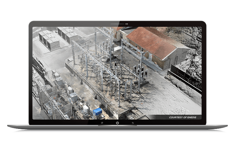
iTwin Capture Engine and iTwin Capture Cloud Services Supports a wide variety of input data, including RGB images, thermal images, image metadata (CSV, EXIF), videos, and lidar point clouds in LAS, LAZ, OPC and POD formats.
Thanks to iTwin Capture Engine, you can perform different types of treatments: automatic calibration, aerial triangulation and beam adjustment, 2D reconstruction with RGB orthophotos and thermal or digital models of elevation, 3D reconstruction with realistic meshes and Gaussan flats, as well as soil extraction.
Generated deliverables include air triangulation reports, 3D meshes, Gaussian flats, point clouds, orthophotos, and digital elevation, surface and terrain models.
iTwin Capture Modeler Flex, free, provides tools to manage your projects and productions, upload your data to iTwin Capture Cloud Services, browse among your photos, retouch 3D meshes and orthophotos, and perform measurements of position, distance, volume and surface.
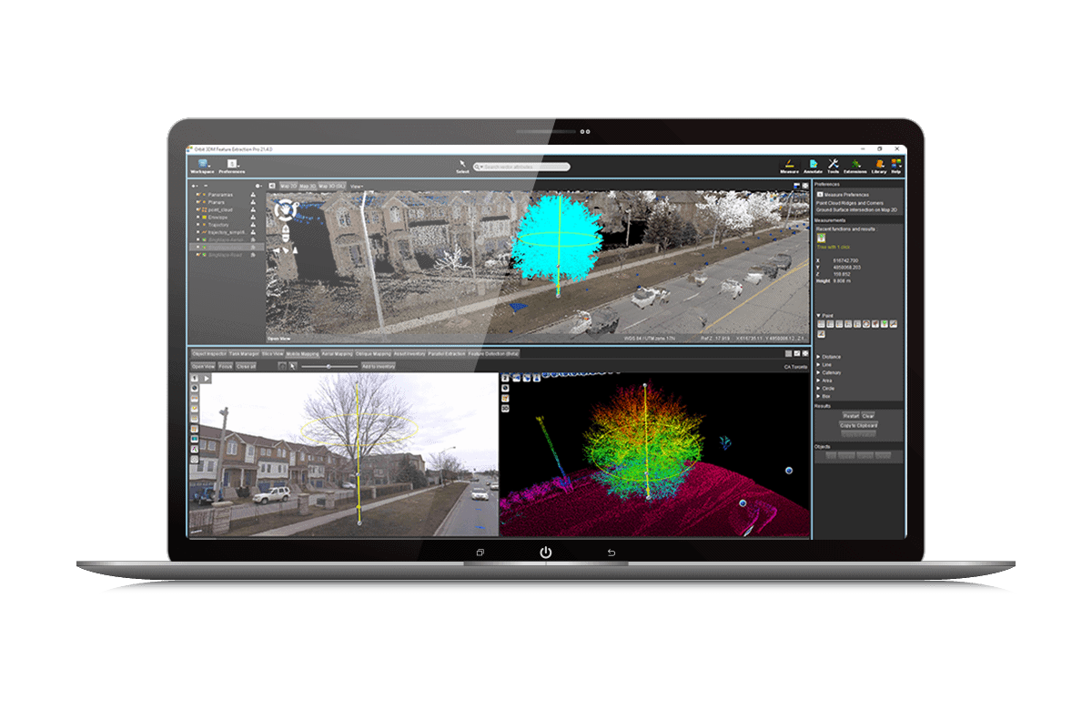
iTwin Capture Manage & Extract allows you to centralize, visualize and analyze all your reality data, whether it be images, lidar point clouds, 3D grids or 2D GIS data. The tool combines these sources in a single environment, in 2D or 3D, to ensure clarity and consistency between teams.
You can measure points, lines, surfaces and volumes, extract information to GIS or CAD, automate analysis with the AI, and generate profiles, cuts or contour lines. Workflow management is simplified: cataloguing, indexing, accuracy correction, data cleaning and georeferencing, as well as preparation for cloud and web applications.
iTwin Capture Manage & Extract turns your complex data into reliable and usable information for faster, more accurate and collaborative projects.
Bentley Descartes allows you to turn your cloud of points, images and 3D meshes into usable data for your infrastructure projects. The tool centralizes and organizes all your reality information in a unique environment, in 2D or 3D, to ensure consistency and accuracy at each stage of the project.
You can extract accurate measurements, generate surfaces, digital models or orthophotos, and easily integrate your data into your GIS or CAD workflows. With advanced analytical tools and automated processing capabilities, Descartes helps you create reliable deliverables quickly, while facilitating collaboration between teams.
In summary, Bentley Descartes turns your raw data into clear and usable information for faster, accurate and efficient projects.
User Word
Through these data collection methods, the government could achieve potential annual savings of at least S$5 million, with an update cycle every two years.
— Hui Ying Teo, Senior Surveyor, Singapore Land Authority