PLAXIS 3D
Geotechnical engineering
PLAXIS 3D transforms geotechnology into accurate and reliable simulation. Analyze soils, predict the behavior of foundations and structures, and secure your projects with powerful 3D models. The ideal tool for fast, safe and optimized decisions.
PLAXIS 3D: the tool that transforms your soil analyses into reliable decisions
3D soil analysis, reliable results
PLAXIS 3D allows geotechnical engineers to perform advanced 3D finite element analyses for ambitious projects in the civil, mining, energy and environmental engineering sectors.
Study excavations, surface, pile and offshore foundations, embankments, soil improvement measures and tunnels. Consider static, dynamic or seismic loads as well as complex hydrological conditions with temporal variations in water level and flow.
Raise your geotechnical projects to the next level with PLAXIS 3D.
PLAXIS 3D
PLAXIS 3D offers a fundamental choice for routine assessments of soil and rock deformation and safety.
PLAXIS 3D Advanced
Free the full potential of PLAXIS 3D by accessing its full range of features:
- PLAXIS 3D
- Flow-deformation or creep coupling
- Consolidation analysis
- Groundwater in stationary condition
PLAXIS 3D Ultimate
Expand the capabilities of PLAXIS 3D Advanced:
- PLAXIS 3D Advanced
- Analysis of vibration effects
- Simulation of hydrological and time-dependent variations in water levels or flow functions
Geotechnical Analysis 3D WorkSuite
The most complete 3D geotechnical solution in Seequent.
It includes:
- PLAXIS 3D Ultimate
- GeoStudio 3D Ultimate
What is PLAXIS 3D?
PLAXIS 3D incorporates all the essential features to easily perform daily soil and rock deformation and safety analyses. This complete software for the design and analysis of soils, rocks and associated structures allows you to model in complete 3D.
What is PLAXIS 3D Advanced?
PLAXIS 3D Advanced includes all the features of PLAXIS 3D, while enriching your geotechnical design capabilities with advanced features and additional material models.
Vous pouvez prendre en compte le fluage ou le couplage écoulement‑déformation via l’analyse de consolidation. De plus, grâce au solveur multicœur, vos calculs sont réalisés plus rapidement qu’avec PLAXIS 3D classique.
What is PLAXIS 3D Ultimate?
PLAXIS 3D Ultimate expands the capabilities of PLAXIS 3D Advanced, allowing you to analyze the effects of vibrations in the ground, whether seismic or related to traffic and mobile charges. You can also simulate complex hydrological conditions through temporal variations in water level or flow functions on model and soil boundaries.
3D geotechnical dynamic modelling
PLAXIS 3D Ultimate is simple to use and designed for advanced seismic analysis. Ideal when vibrations exceed low frequencies, it allows to:
Study the impact of natural or man-induced vibrations on the ground
Analyze the effects of earthquakes, pile strikes, vehicle traffic, heavy machinery or train crossings
Accurately calculate vibration effects with dynamic analyses when load frequency exceeds natural soil frequency
Conduct soil response and liquefaction analyses with the UBCSand model
3D underground flow modelling
PLAXIS 3D Ultimate goes beyond the steady-state groundwater flow analysis:
Simulates unsaturated, temporal and anisotropic soil behaviour
Permet le calcul simultané des variations de pression interstitielle et de déformations grâce à une analyse couplée flux‑déformation
Offers a "Flow-only" mode to exclude movements and constraints if only underground flow interests you, for more simplicity
What is Geotechnical Analysis 2D WorkSuite?
Geotechnical Analysis 3D WorkSuite includes PLAXIS 3D Ultimate and GeoStudio 3D Advanced, providing the most complete 3D option for your geotechnical projects.
With GeoStudio 3D Advanced you can:
Conduct 3D slope stability analyses for soils and rocks
Simulating groundwater flow under various conditions
Integrate pore pressure results into your stability analyses for more accurate and advanced assessments
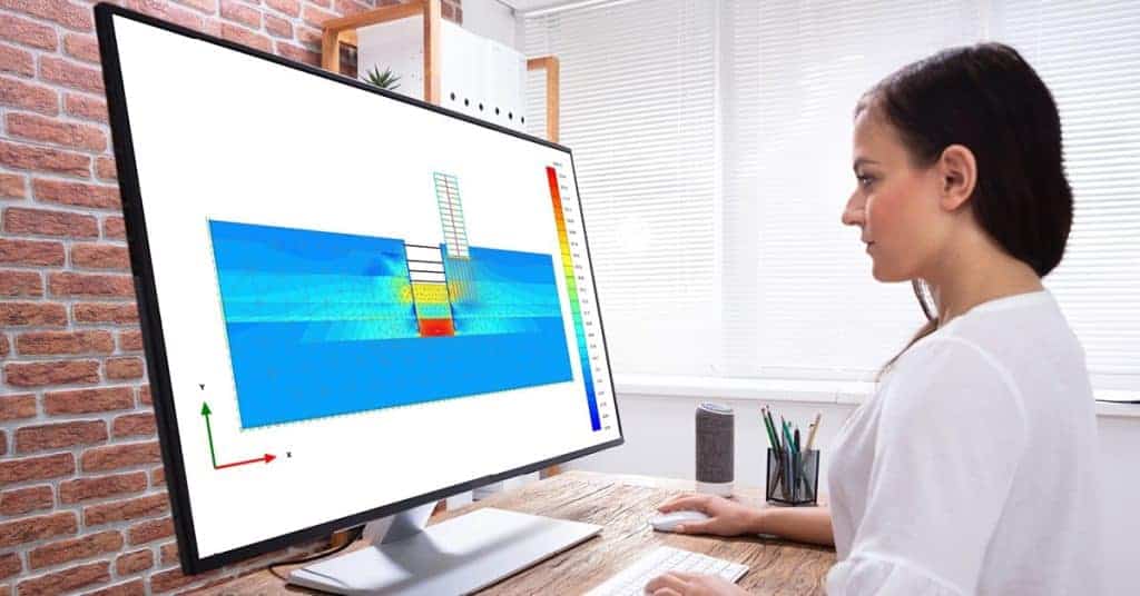

PLAXIS 3D
PLAXIS 3D includes all essential features to perform daily soil and rock deformation and safety analyses. This comprehensive software for the design and analysis of soil, rock and associated structures facilitates full 3D modelling.
Key Features
Address your infrastructure challenges reliably
Generate and easily adapt construction sequences for excavations. Perform steady-state groundwater circulation calculations, including flow parameters, boundary conditions, drains and wells. Model the interactions between soil and foundation, such as slips or gaps, using integrated pile interfaces and elements. Get reliable results with realistic soil models and a full portfolio of visualization tools.
Get realistic assessments of constraints and travel
To meet the unique challenges of soil-structure interactions, PLAXIS 3D offers different types of calculations: plastic analysis, consolidation and safety. A wide range of material models predict the behaviour of various soils and rock types. Combined with robust calculations, they guarantee reliable results. View these forces in multiple ways and use cross-sections to examine certain areas in detail.
Earn efficiency through multidisciplinary workflows
Create logical geotechnical workflows that cover the entire project, from the import of subsurface data to the design, analysis and production of various deliverables.
Ability to manage large CAD files
PLAXIS's ability to work effectively with design, construction and contractor teams is its main asset. At meetings, I can respond quickly to stakeholder requests by adjusting geometry and sharing different scenarios. The ability to model instantly allows us to avoid endless exchanges of emails and phone calls.
— Brice Exley, Engineer, Haley & Aldrich
Licensing Options
Annual rental
The simple and efficient way to use software over a fixed period of 12 months. The license is associated with the user and can be used on several posts (but not simultaneously).
The annual subscription includes a number of "keys" that can be exchanged for training or accompaniment (mentoring).
Perpetual licence
A perpetual license is a unique purchase, it can be accompanied by an annual maintenance contract called SELECT. The latter assures you that your software is always up to date, 7 days a week and 24 hours a day support and allows for the buoyancy of licenses among other services.
The SELECT contract offers maintenance for your perpetual licenses including various benefits:
- Floating licences
- Software updates
- Balancing the licensing portfolio
- Technical assistance 24/7, 365j/365
- CONNECT services