LiDAR or photogrammetry? Everything you need to know.

With the recent development of drones in the field of surveys of existing situations, there are many myths and misconceptions around the LiDAR and the photogrammetry by UAV. In fact, these two technologies have as many differences as similarities. It is therefore essential to understand that they:
- offer different products
- generate different deliverables
- require different capture conditions
- but especially that they must be used for different uses.
There is no doubt that, compared to traditional survey methods, both technologies offer much faster results and a much higher data density. Both techniques measure all visible objects without interpolation). However, selecting the best technology for your project will depend among other factors:
- use case
- Environmental Conditions
- terms of delivery
- Budget.
The purpose of this article is to provide a detailed overview of the strengths and limitations of LiDAR and the photogrammetry. It will allow you to help you choose the right solution for your project.
Contents
- How do both technologies work?
- Results of measurement campaigns by LiDAR and photogrammetry
- Precision
- Data acquisition, processing and efficiency
- Cost assessment
- Conclusions
- Original source
How do both technologies work?
Let's start from the beginning and look more closely at the science behind the two technologies.
LiDAR which means Light Detection and Ranging is a technology based on laser beams. It pulls with laser and measures the time it takes for the light to return. That's what we call a active sensor because it emits its energy source rather than detecting the energy emitted by objects on the ground.
The photogrammetry on the other side is a technology Passive. It is based on images transformed from 2D into 3D cartometric models. It uses the same principle as human eyes or 3D videos to establish a depth perception. This allows the user to see and measure objects in three dimensions. The limitation of photogrammetry is that it can only generate points based on what the camera sensor can see.

In short, the LiDAR use lasers to perform measurements. The photogrammetry is based on the analysis of captured images. These can be processed and combined to allow for measurements.
Results of measurement campaigns by LiDAR and photogrammetry
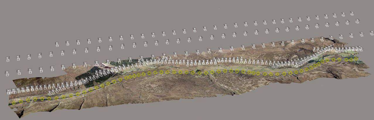
The main product of surveys carried out by LiDAR is a 3D point cloud. The density of the point cloud depends on sensor characteristics (scanning frequency and repeat rate), as well as flight parameters. Assuming that the scanner pulses and oscillates at a fixed rate, the cloud density of points depends on the flight altitude and speed of the aircraft.
For example, for the modeling of power lines, you will have to choose a dense cloud of points with more than 100 points per square metre, while to create a digital land model of a rural area, 10 pts/m2 will suffice.
It is also important to understand that the sensor LiDAR captures only colorless dots (RGB), creating a monochrome data set that can be difficult to interpret. To make it more meaningful, data are often visualized using false colours based on reflectivity or elevation.
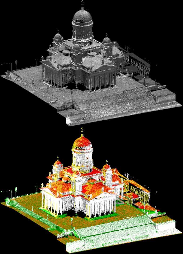
It is possible to overlay the color on the data LiDAR post-processing on the basis of images or other data sources. This adds some complexity to the process. The colour can also be added according to the classification. It is thus possible to classify each point according to a particular type / group of objects. Trees in green, buildings in white, cars in blue, floors in brown, electric wires in red, for example.
On the other hand, the photogrammetry can generate models in 3D and 2D field colours. It should be noted that various spectra can be supported (infrared for example). These models are easier to visualize and interpret than those produced by LiDAR. The main results of the photogrammetric surveys are:
- orthophotoplans
- Phototextured 3D meshes (NdT)
- Digital surface models
- of the Dot clouds 3D
These various types of productions are created from the assembly and processing of hundreds or thousands of images. The outputs are very visual with a pixel size (or Ground Sampling Dresistance – GSD) may be less than 1 cm.
In this context, the photogrammetry appears to be the technology of choice for use cases where visual evaluation is required (e.g. construction inspections, asset management, agriculture). The LiDAR, on the other hand, has certain characteristics which make it interesting for particular use cases.
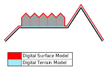
Laser beams as active sensor technology can penetrate vegetation. The LiDAR is able to pass through the spaces in the canopy and reach the ground and objects below, so it can be useful to generate digital terrain models.
The LiDAR is also particularly useful for modeling narrow objects such as power lines or telecommunications towers. The photogrammetry may not recognize narrow and poorly visible objects. In addition, the LiDAR can work in poor lighting conditions, and possibly at night. The Dot clouds generated by photogrammetric processes are more visual (each pixel is defined in RGB), but often with generalized details, so they can be suitable for objects for which a lower level of geometric detail is acceptable but for which visual interpretation is essential.
Precision
Let's start by defining what precision is. In topography, precision always has two dimensions: relative and absolute. Relative accuracy is the measurement of the position of the objects relative to each other. Absolute accuracy refers to the difference between the location of the objects and their actual position on the Earth (which is why a survey may have good relative accuracy but low absolute accuracy).
Reach a high level of precision with a Air LiDAR However, it is quite difficult because the sensor is moving. That's why the sensors Airborne LiDAR are always coupled with a IMU (inertial motion unit) and a receiver GNSS, which provide information on the position, rotation and movement of the scan platform. All of these data are combined on the fly to achieve high relative accuracy (1-3 cm). To obtain high absolute precision requires the addition of 1-2 ground control points (GCP – Ground Control Point) and other control points for verification purposes. In some cases, positioning accuracy GNSS additional is necessary, one can use positioning systems RTK / PPK advanced. LiDAR is one of the most accurate surveying technologies. This is particularly the case for terrestrial lasers where the sensor is positioned on the ground, and its exact location is measured using topographical methods. Such a configuration allows to achieve sub-centimetric level accuracy.
The photogrammetry It also allows for level accuracy of 1 to 3 cm, but requires significant experience to select the appropriate equipment, define flight parameters and process data appropriately. High absolute precision requires the use of technology RTK / PPK and GCP or can be based only on a large number of GCP. Nevertheless, using a drone DJI Phantom a cost of around 500 $ and positioning several GCP, you can easily get an absolute accuracy of 5 to 10 cm for smaller area surveys, which can be sufficient for most use cases.
Data acquisition, processing and efficiency
There are also significant differences in the rate of acquisition between the two technologies.
In photogrammetry, one of the critical parameters required to accurately process the data is the image overlap that should be 60-90% (front and side) depending on the structure of the terrain and the material used.
Surveys by LiDAR conventionally only require 20 to 30% overlap between flight lines, which makes data acquisition operations much faster.
In addition, in order to obtain absolute accuracy, the photogrammetry requires more ground control points to obtain an accuracy equivalent to that of LiDAR. Measurement of GCPs usually requires traditional surveying methods, which involves additional time and costs.
Data processing LiDAR is very fast. The raw data requires only a few minutes of calibration (5-30min) to generate the final product. In photogrammetrydata processing is the longest part of the overall process. In addition, it requires powerful computers capable of managing operations on gigabytes of images. On average, processing takes between 5 and 10 times longer than acquiring data in the field.
On the other hand, for many cases of use such as inspections of power lines, Dot clouds LiDAR require additional classification that may require a lot of work and often require expensive software (e.g., TerraScan ).
Cost assessment
When looking at the total cost of the surveys LiDAR and photogrammetricThere are several elements to consider. First of all the material. Sensor sets LiDAR for UAV (scanner, IMU and GNSS) cost between 50,000 $ and 300,000 $, but in most cases high-end devices are preferable. When you invest so much in a sensor, you want to minimize the risk of accidents. In this spirit, most users spend between 25,000 and 50,000 $ to acquire one UAV quality and reliable. All this amounts to 350,000 $ for one measuring equipment which is equivalent to 5 Tesla Model S. It is quite expensive!
For the photogrammetryAll you need is a drone equipped with a camera. These tend to be much cheaper. In the range of 2,000 $ 5 000 $, you can find a wide selection of professional multi-rotor devices. The DJI Inspire This is an example. In a price range of 5,000 $ – 20,000 $, you can buy compatible sets RTK / PPK. The DJI Matrix 600 (multi-rotor) or fixed wing aircraft Sensfly eBee or PrecisionHawk Lancaster For example.
Another cost element is the processing software. In the case LiDAR, it is usually added free of charge by the sensor manufacturer. However, post-processing operations such as classification of Dot clouds, could require the use of third-party software such as TerraScan, which costs between 20,000 $ and 30,000 $ for one license. The prices of software photogrammetry are lower cost for basic uses.
Of course, another important factor affecting the cost of service is the work and duration of benefits. Here, the LiDAR has a significant advantage over the photogrammetry, because it takes not only much less time to process the data, but also to pose and mark the GCPs.
Remarks :
- In software such as iTwin Capture Modeler, it is possible to materialise GCPs (reference points) in the form of QR Codes which are automatically recognized by the application. The user identification phase of GCPs is therefore non-existent and the accuracy is much higher.
- Some modern drones are equipped with a RTK GNSS system allowing precise positioning of the optical center when taking a photo. This makes it possible to free GCP from positioning if this is for control purposes.
On the whole, depending on the use case and the economic model, the photogrammetry are generally cheaper than LiDAR. This is explained by the investment in the equipment to be amortised. However, in some cases, the efficiency gains in LiDAR can offset the cost of the sensor.
Conclusions
When comparing the LiDAR and photogrammetryIt is essential to understand that both technologies have their applications and limitations, and that they are complementary in most cases of use. None of these technologies is better than the other and none will cover all cases of use.
The LiDAR should certainly be used for surveying narrow structures such as power lines or telecom towers. It can also be useful for mapping areas under canopy. The photogrammetry will be the best option for projects that require visual data. Construction inspection, asset management, agriculture for example. For many projects, both technologies can provide valuable data (e.g. mines or earthworks). The choice of method will depend inter alia on:
- use case
- time available
- budget
- catch conditions.
The LiDAR and photogrammetry are two powerful technologies if you use them in the right way. It is clear that with lower hardware and software prices, they will become more and more affordable. Both technologies are still in their early stages in drone applications. In the coming years, we will undoubtedly see other developments. These will concern the price of hardware and automation of machine learning software.
Stay tuned, we'll keep you informed.
Original source
This article is a translation of "Drone LiDAR or Photogramtry? Everything you need to know." written by Aleks Buczkowski.