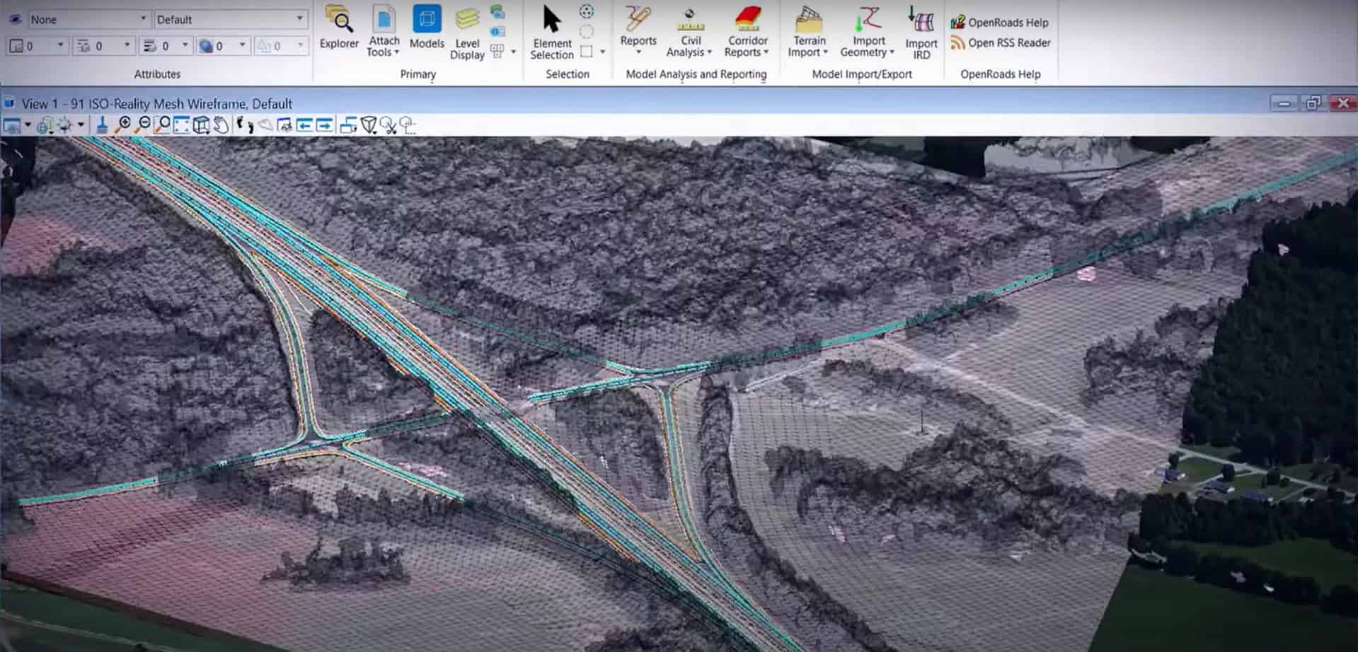
OpenRoads Designer, Bentley Systems' civil engineering design software, enables the precise design, analysis and optimization of linear roads and infrastructures. This article focuses on one of its most powerful features: dynamic road corridor modelling.
OpenRoads Designer is a detailed design application covering survey, drainage, underground networks and road design, which replaces the capabilities previously offered by InRoads, GEOPAK, MX and PowerCivil. Its model-based approach facilitates work with different types of data, disciplines and distributed teams to produce 2D deliverables such as accurate and georeferenced 3D models. Used for interchanges, roundabouts, site development or stormwater systems, the solution is for both small and very large civil engineering projects.OpenRoads Designer brings together lift, drainage and road design in a single application.
Focus functionality: dynamic modelling of road corridors
Corridor modelling is the core of the OpenRoads Designer design engine. It allows to develop each aspect of a road (floor, shoulder, slope, ditches, associated structures) within a unique parametric presentation, rather than separately managing dozens of typical cuts.
Navigate and design in real time along the route
Engineers can move quickly along the corridor at controlled intervals by simultaneously viewing and modifying all road components. Cross-sections and profiles are created from any point of the route and are updated on the fly as soon as a change is made to the model, including terrain.
Parametric intelligence for BIM compliance
Thanks to a geometric rule engine, the model automatically updates itself to reflect the design intent, while meeting the requirements for complex modelling and file federation required for BIM level 2 and beyond. Horizontal and vertical alignments remain permanently associated, ensuring project coherence at each stage.
From 3D model to project deliverables
The modeled corridor directly feeds planes, profiles, cuttings and installation reports, as well as the standard formats for guiding earth-moving machines (Trimble, Topcon, Leica), thus linking the design to execution on site.Parametric design of a road corridor in OpenRoads Designer.
The 10 key points of OpenRoads Designer
Functionality
Benefit for your projects
Unique parametric modelling of the corridor
All road components developed in a single coherent presentation.
Dynamic navigation along the route
Move at controlled intervals to design in context.
Dynamic cross sections
Real-time update with each model or field change.
Profiles and cuts from any point of the route
Generation on demand, without manual reconstruction.
Related horizontal and vertical alignments
Coherence guaranteed between plan and long profile.
Land modelling and analysis
Include survey data and existing conditions.
Intelligent geometric rules motor
The model is automatically updated according to design intent.
BIM Compliance Level 2 and Beyond
Federation of multi-discipline files for wider collaboration.
Integrated drainage and underground networks
Hydraulic and hydrological design in the same application.
Export to machine guidance
Trimble, Topcon and Leica compatible formats for earthmoving.
Case of practical use
Corridor modelling is used on road projects of all sizes: highway expansion, roundabout design, industrial site development or large linear projects. Several project managers who have adopted OpenRoads Designer are earning several million euro thanks to the reduction of design recoveries and the acceleration of studies.OpenRoads Designer training led by beCAD to master corridor modelling.
Why choose OpenRoads Designer with beCAD?
Bentley Systems, beCAD, a licensed vendor, trainer and integrator, supports design offices and public works companies in the deployment ofOpenRoads Designer : advice on the adapted licence, training in the modelling of corridors and technical support.
Frequently Asked Questions
Does OpenRoads Designer replace InRoads, GEOPAK or MX?
Yes. OpenRoads Designer combines and replaces the capabilities previously offered by InRoads, GEOPAK, MX and PowerCivil within a single application.
Does corridor modelling require another software for drainage?
No, OpenRoads Designer natively integrates hydraulic and hydrological design and analysis, without requiring third-party software for rainwater systems.
Is OpenRoads Designer compatible with BIM requirements?
Yes, it responds to BIM Level 1 and allows progress towards BIM Level 2 and beyond through 3D modelling, interoperability and multi-discipline federation. Would you like to evaluate OpenRoads Designer on your own road projects or train your teams in corridor modelling? Discover the product sheet or contact the beCAD team.
We use cookies to guarantee you the best experience on our website. If you continue to use this site, we will assume that you are satisfied with it.