iTwin Capture Modeler, Bentley Systems 3D reality modeling software, transforms simple photographs or clouds of LiDAR points into 3D reality meshes, orthomosaic and Gaussian Splats ready for engineering. This article details its flagship functionality: the generation of high-precision 3D reality data, now enriched with the Gaussian Splatting.
iTwin Capture Modeler is Bentley Systems' reality modelling application, designed to prepare, organize and pilot your reality capture projects. It allows you to import photographs or clouds of LiDAR points, then to entrust their processing to the iTwin Capture Engine (locally or via iTwin Capture Cloud Services) in order to produce faithful digital twins of your existing infrastructure: buildings, art works, industrial sites, construction sites or entire territories. Formerly known as ContextCapture, iTwin Capture Modeler is now part of Bentley's iTwin ecosystem and is the starting point for any Bentley project. reality modelling : from field survey to integration into a digital twin that can be used in engineering.The iTwin Capture Modeler interface allows to organize a capture project before processing.
Focus functionality: generating 3D reality meshes and Gaussian Splats
The central feature of the iTwin Capture Modeler is to convert raw data (photos, drone images, LiDAR scans) into usable 3D deliverables. It's the engine. iTwin Capture Engine which executes this processing, locally for speed and confidentiality of data, or in the cloud via iTwin Capture Cloud Services to absorb the largest projects.
From point cloud to usable 3D model
From the imported data, the software automatically calculates multi-resolution reality meshes, digital surface models, true orthosaic (true ortho) or classified point clouds. Accuracy adjusts at project level: from a simple work to the modelling of an entire city.
The Gaussian Splatting Novelty
Bentley Systems has integrated the Gaussian Splatting at iTwin Capture Modeler: this rendering technique restores the fine details (cables, antennas, reflective elements) with an unprecedented realism while keeping outputs ready for engineering. The teams thus have a photorealistic rendering without sacrificing the technical exploitability of the model.
Local or cloud processing, at any scale
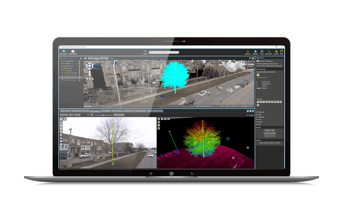
Thanks to the execution of several engines in parallel, iTwin Capture Modeler accelerates the delivery of large projects and allows to move from a single site to a city-scale project without disruption.Classification and extraction of elements from captured reality data.
The 10 key points of the Twin Capture Modeler
Functionality
Benefit for your projects
Flexible data import
Photographs or clouds of LiDAR points imported simply, without heavy technical prerequisites.
Multi-resolution reality meshes
Adjustable precision, from an isolated object to the modelling of an entire city.
Gaussian Splatting
Made photorealistic fine details (cables, antennas, reflective surfaces).
Orthomosaic and digital surface models
Precise cartographic, directly usable in engineering.
Clouds of classified points
Automated extraction and classification of site elements.
Local or cloud processing
Choose between iTwin Capture Engine (local) and iTwin Capture Cloud Services depending on your constraints.
Parallel treatment
Several engines run simultaneously to speed up large projects.
Retouching Tools
Quick cleaning, masks and water constraints to make meshes reliable.
Accuracy measurements and analyses
Measures directly on the model of reality, without intermediate export.
Web streaming and interoperable formats
Online publication and export to OpenBuildings, OpenRoads, MicroStation and more.
Case of practical use
In the field, this 3D reality generation feature serves both the inspection of works of art as well as heritage management or site monitoring. A survey by drone or LiDAR scanner is sufficient to produce a 3D model that can be used for maintenance, work planning or integration into a BIM model.3D modeling of bridges and structures for the management and maintenance of works.
Why go through beCAD for iTwin Capture Modeler?
As a Bentley Systems Authorized Reseller, Trainer and Integrator, beCAD supports design offices, infrastructure managers and public works companies in the deployment ofiTwin Capture Modeler : advice on the choice of license, training in ownership of the software and technical support throughout the project.
Frequently Asked Questions
Is iTwin Capture Modeler free?
Project preparation and organisation are free with iTwin Capture Modeler Flex. The processing of data in grids, Gaussian Splats or point clouds requires either the iTwin Capture Engine or an iTwin Capture Cloud Services subscription.
What is the difference between iTwin Capture Modeler and ContextCapture?
iTwin Capture Modeler is the evolution of ContextCapture within Bentley Systems' iTwin ecosystem: same reality modeling foundations, enriched with new capabilities such as the Gaussian Splatting and enhanced cloud integration.
What data formats can iTwin Capture Modeler handle?
The software accepts photographs (ground or drone) as well as LiDAR point clouds, and produces 3D, orthomosaic, digital surface models, classified point clouds, and Gaussan Splats. Would you like to evaluate iTwin Capture Modeler on your own projects or organize training for your teams? Discover the product sheet or contact the beCAD team.
We use cookies to guarantee you the best experience on our website. If you continue to use this site, we will assume that you are satisfied with it.